
What Dedham Neighbors Records Show
Public records can describe the parcels around a Dedham address, but they do not create a complete household list. The Town's GIS and assessor data are best for a bounded block question. Recorded deeds and plans explain ownership history and legal parcel lines. Historic street directories offer dated address-to-occupant clues. Community organizations can provide public contact routes and neighborhood history, but their member lists are not assumed public.
| Dedham block source | What it can establish | Access route |
|---|---|---|
| GIS parcel layer and Property Viewer | Subject and adjacent parcel geometry, owner display field, address, map/block/lot and local context layers. | Public viewer or published ArcGIS layer; request data and field definitions if needed. |
| Assessors database | Owner of record, situs and mailing-address distinction, parcel identifiers, values, classification and sales clues. | Vision search, street listing, assessor counter or phone. |
| Norfolk deeds and plans | Grantor/grantee parties, legal description, plan references and dated transfers. | Norfolk Research, Registry counter, phone and mail-copy channels. |
| Historic directories | Dated address-to-occupant, telephone or house-guide entries. | State Library, Dedham Museum, libraries and available digital collections. |
| Community organizations | Public contact channel, local project, meeting or neighborhood-history context. | Town nonprofit material, group contacts and public notices, not private rosters. |
The crucial distinction for Dedham neighbors is owner versus occupant. A parcel card may show a tax owner and an off-site mailing address; it does not show every person at the site. A directory is also time-bound. Use a name only after checking which source created it, which address it actually identifies and the date attached to that record.
Find Dedham Neighbors on Parcel Maps
The Dedham GIS Division describes map uses for addressing, infrastructure, property/tax work, services and imagery. The safe adjacent-parcel method starts with a subject address and follows only parcels that actually touch it. A road, river, easement or irregular lot can make a parcel look close on screen without making it an abutting property.
- Search or zoom to the Dedham subject address in the Property Viewer, then record the subject parcel's address and map/block or parcel identifier.
- Select each touching parcel polygon and record its situs number, owner display name, map/block/lot and GIS or assessor identifier.
- Check each parcel against the Dedham Online Assessors Database to separate the physical situs from the mailing address and to confirm the current card.
- Use a plan or Norfolk deed only when an ownership boundary or earlier transfer needs explanation. For a full named-street trail rather than one block, use the Dedham street directory.
GIS layers for zoning, historic districts, aerial imagery and other features describe place. They are useful block context, but they do not prove title, residence or household membership. For a long street, divide the work by address range or map area. The published parcel layer has a 2,000-record maximum for queries, another reason to use a tight block question.
Dedham GIS Fields for a Block
The published Dedham tax-parcel feature layer exposes parcel geometry and fields that help keep an adjacent-parcel worksheet consistent. Its owner display field is own_name1. It also includes parcel, map, block, lot, address and assessment fields. The layer supports advanced queries, statistics and JSON, GeoJSON and PBF outputs, but its schema does not supply a complete personal-privacy narrative. Do not infer occupants from a polygon or a displayed owner name.
| Owner display | own_name1 and additional owner fields in the service schema. |
|---|---|
| Parcel keys | rem_pid, account and alternate parcel IDs, plus map/block/lot fields. |
| Situs fields | rem_prcl_locn, street, number, number character and apartment fields. |
| Property context | Land area, buildings or sections, bedrooms or units, assessment values and exemption value. |
| Map record | Polygon tax parcel with published layer geometry, not a record of every person connected to the property. |
The public tax-parcel layer is the source shown below. It is most useful when every entry on a Dedham block is captured with the same parcel and situs fields.
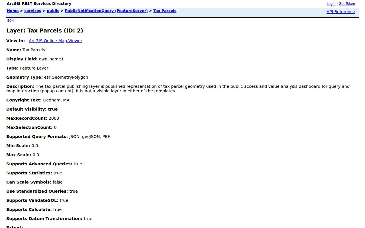
The map layer makes an adjacent-parcel question visible, yet the result still needs an assessor-card or deed check. A shared mailing address, a trust, an estate or an off-site owner can change the meaning of the first result.
Dedham Neighbors and Owner Records
The assessor database supports address, owner surname, map/block, parcel ID, street listing and sales searches. Its FY2026 values reflect full and fair cash value as of January 1, 2025, using 2024 sales. That date makes the card a current municipal assessment source, not a permanent residence record. The street listing is useful for comparing assessed owners along a short stretch, while the sales search can suggest a transaction to verify at the Registry.
To follow a transfer, search the owner in Norfolk Research as grantee, then read the deed's legal description and prior-reference clause. Norfolk recorded land reaches 1793, Land Court material begins in 1900, and the plan index can be searched by book/page, plan number/year, street, owner or surveyor. When a deed and a parcel card seem to conflict, compare the plan, lot, map/block and abutting-owner references before deciding they concern the same Dedham lot.
Note: The tax mailing address can be a useful contact or correspondence clue, but it is not proof that the owner lives at the parcel.
Community Contacts Around Dedham Blocks
Dedham community groups are a different layer from title or parcel records. They can point to public projects, meetings and neighborhood history. The Town's nonprofit and community list provides public organization references, while town notices and each group can provide a public contact route. The research did not locate private member directories for these groups, so a roster must never be assumed from a neighborhood name.
| Dedham organization or resource | Block or neighborhood value | Public access boundary |
|---|---|---|
| Oakdale Square Alliance | Oakdale neighborhood context and active group references. | Public organization/contact references; member roster not located. |
| Mother Brook Community Group | East Dedham and Mother Brook community context. | Town notices and group channels; private roster not located. |
| Manor Neighborhood Association | Manor playground, flood and southeast Dedham context. | Public event/contact references; private list not located. |
| Riverdale Neighborhood Association | Riverdale civic and neighborhood context. | Town notices and community channels; private directory not located. |
| Dedham Civic Pride and Square Circle | Townwide civic activity and Dedham Square context. | Public organization references, not a household directory. |
| Dedham Community House | Townwide program context. | Public address, phone, email and organization route; participant information is not public. |
The Dedham Museum & Archive is another useful public route for older streets, buildings, families and organizations. Its collection database and research materials may explain a block's past without converting a donor, member or participant reference into a current resident record.
Dedham Neighborhood Geography Adds Context
Dedham planning material uses six neighborhood labels: Riverdale, West Dedham, Dedham Village, East Dedham, Oakdale and Greenlodge/Sprague/Manor. These names are search synonyms for a directory, map or local newspaper, not separate records jurisdictions. The Town's census crosswalk links them to particular tract and block groups, which can help explain a planning document without replacing the parcel or legal description.
The Manor illustrates why geography matters. The watershed plan describes roughly 120 acres, 460 parcels and about 2,000 residents, with flood-zone context. A GIS layer can therefore make the physical setting of a block clearer than a postal label alone. Use flood, historic and zoning layers for context, then return to the assessor and Registry for the property record itself.
Dedham Neighbors Are Not a Voter Roll
Massachusetts does not offer a public web search for all Dedham voters on a block or within a distance of an address. The official My Voter Registration Status form requires first name, last name, date of birth and residential ZIP, and it is intended for the individual voter to check that person's status. A result may provide registration or polling information; it is not a neighborhood directory or evidence of a ballot choice.
Under M.G.L. c.51 §47C, central-registry names and addresses are not ordinary public records. For a local list or annual register, make a written request to the Dedham Town Clerk that identifies the specific record and year. The Clerk and Board of Registrars apply confidential-voter and public-record rules. The Town Clerk is at 450 Washington Street; the general office number is 781-751-9200 and the election contact listed in the research is Paul Munchbach at 781-751-9201.
Choose Sources for Dedham Neighbors
Official records are specific about what they can verify and who created them. A commercial neighbor-search category can be convenient, but it may merge people, age poorly or fail to identify its source. For a block question, source labels and dates matter more than a broad list. Start with the public parcel, then add a deed, dated directory or public community contact only when it answers a defined question.
| Source type | Strength for a Dedham block | Limit to keep in view |
|---|---|---|
| Official parcel, assessor and deed records | Identifies a parcel, owner of record, legal land history and source date. | Does not establish all occupants or a private household roster. |
| Historic directories and museum material | Provides a dated occupancy or place-history snapshot. | May be stale, partial, differently numbered or organized under an old neighborhood label. |
| Commercial neighbor-search category | May offer a starting name or address lead. | Accuracy, source date and lawful-use boundaries can be unclear; confirm with a custodian. |
Protect Privacy When Finding Dedham Neighbors
Parcel ownership is not household composition. Utility and delivery-customer information are not public resident rolls, and DMV addresses are closed under the federal Driver's Privacy Protection Act. Massachusetts Address Confidentiality Program participants, confidential voters, court-protected addresses and sensitive police or victim information can be absent or substituted in lawful ways. Do not attempt to reconstruct protected details by combining adjacent records.
Lawful use. Use Dedham neighbor records for civic questions, personal safety awareness, family reconnection and neighborhood history. Do not use parcel, contact or address information to watch, stalk, harass or intimidate anyone.
When public GIS information needs clarification, ask the GIS Division for the dataset date, version and field definitions. For a defined Town record, use Dedham's public-records request route and describe the parcel, date range and fields needed. The Massachusetts Public Records Law generally calls for a custodian response within 10 business days, subject to exemptions and fee rules.