
Dedham ZIP Coverage and Delivery
USPS sources identify two ZIPs for Dedham. The key distinction is delivery type. ZIP 02026 is the standard ZIP associated with physical Dedham addresses, while 02027 is a Dedham Post Office PO Box ZIP. The USPS postal lookup is the current authority for a particular Dedham street address. It can return ZIPs for a city and state, identify the ZIP for an address, or show cities associated with a ZIP. A city-state result can include both codes without making each one a physical residential area.
| ZIP | Areas covered | Post office | Notes |
|---|---|---|---|
| 02026 | Standard Dedham delivery addresses, subject to address verification | Dedham Post Office, DEDHAM MA routing | Associated with physical Dedham addresses |
| 02027 | Dedham postal service through PO Boxes | Dedham Post Office | PO Box classification, not a residential street boundary |
Postal routing is not a legal boundary. A ZIP label can differ from the town line, and a Dedham parcel can use an adjacent postal place. For a Dedham municipal record, confirm the parcel in the assessor or GIS system and confirm the event jurisdiction with the Town Clerk.
Dedham ZIP 02026 or 02027
The Dedham postal directory should not treat 02026 and 02027 as interchangeable filters. A Dedham result using 02026 may help standardize a physical address for an assessor search. A result using 02027 may establish a postal mailing route only. It does not identify a house, parcel, or municipal residence. This is the central comparison for local postal research, particularly when an address, deed, or directory uses a different mailing and physical location.
USPS lists 02026 to 02027 under Dedham, MA 02026 sorting. That relationship does not supply a historic boundary map, and research found no official Dedham ZIP split, realignment history, street-by-street ZIP map, or per-ZIP registration table. Use current USPS results for current postal verification, then use dated directories, maps, deeds, and newspapers for Dedham historical address questions.
Note: A PO Box ZIP can support a mailing detail, but it is not evidence of a person's physical residence or parcel location.
Verify a Dedham Postal Code
Use the USPS tool before a Dedham property or records request. Enter the street address to obtain the delivery ZIP, use the city-and-state option to see the ZIPs USPS associates with Dedham, or enter a ZIP to see the cities associated with it. Save the address, preferred city, state, and ZIP exactly as returned. That preserves the postal form without assuming it is also the town's legal description.
The USPS lookup screen provides the address, city/state, and cities-by-ZIP routes used for this check.
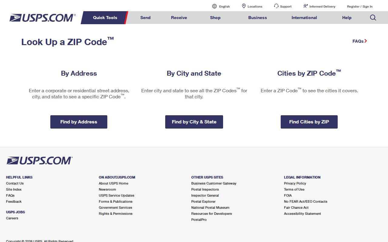
The returned postal result is the starting format for a Dedham local search, not a substitute for a parcel record, deed description, or Town Clerk jurisdiction check.
Dedham ZIP Property Tools
Dedham's local property tools are not ZIP-first systems. The Town of Dedham Online Assessors Database publishes searches by street address, owner surname, map/block, parcel ID, street listing, and sales search. The Town's Dedham property information page also directs users to tax maps and the Property Viewer. Start with the USPS-standardized Dedham street address, then use the situs address, which means the physical location of the parcel.
Dedham GIS is parcel and spatial first rather than ZIP first. Its public layers include parcels, assessing, zoning, historic districts, and other geographic features. A property card or parcel layer can show an owner display name, parcel identifiers, situs fields, assessments, and map geometry. It does not establish every resident or household member at the address. For a named-street investigation after a ZIP is narrowed, the Dedham street directory provides the address-based workflow.
The published tax-parcel service has fields for the owner display name, parcel and account identifiers, map, block, lot, street number, street name, apartment, assessment values, and polygon geometry. It supports advanced queries and published data formats, but no public ZIP field was verified in the exposed schema. A map result therefore needs an address or parcel starting point. Ask GIS for the layer date, field definitions, and any documented spatial-selection method before treating a custom selection as a ZIP result.
Note: No public ZIP field was verified in the Dedham parcel schema, so confirm postal sorting before making a records request.
Find Residents With a Dedham ZIP
A ZIP can organize the first step, but it cannot create a ZIP-wide public people list in Dedham. Begin with a known Dedham street address and use USPS to validate the postal format. Then search the address or parcel through the assessor and GIS tools. If the goal is historical, use the confirmed Dedham street name with a dated directory, map, or Museum building file. Each source has a narrower purpose than the broad idea of finding all residents in a ZIP.
- Run the known Dedham address through USPS and save the returned preferred city, state, and ZIP.
- Search the situs address, owner surname, map/block, or parcel ID in the Dedham assessor database.
- Open the parcel in Dedham GIS to confirm the property geography and available public fields.
- For an older address, compare the street spelling with directories, maps, Museum building files, and deed legal descriptions.
- Ask the relevant custodian whether ZIP is stored as a field before requesting a ZIP-based extract or spatial selection.
The resulting property trail may identify an owner, a parcel, or an address history. It must not be treated as proof of current household membership.
Dedham ZIP Voter Checks
Massachusetts My Voter Registration Status uses a residential ZIP as one part of an individual's own status check. It is not a ZIP-wide Dedham resident directory. The form asks for first name, last name, month, day, and year of birth, residential ZIP, and an agreement statement. The state advises users to try the registered name, consider a previous ZIP after a move, and allow two to three weeks for a recent registration to appear. A non-match can mean the record was not found, not that the person has no connection to Dedham.
| Voter-status field | Form type | Required | Dedham ZIP note |
|---|---|---|---|
| First and last name | Text | Yes | Use the name at registration; a nickname can fail. |
| Date of birth | Month, day, and year selectors | Yes | Identity information, not a location-only query. |
| Residential ZIP code | Text | Yes | Use the five-digit ZIP at which the voter qualified to vote. |
| Agreement statement | Checkbox | Yes | The tool is intended for the individual voter to check status. |
Central-registry names and addresses are not ordinary public records under M.G.L. c.51 §47C. For a dated local annual register or census record, write to the Dedham Town Clerk with a precise year and record request; the office applies public and confidential-voter rules.
Dedham Postal Routes and Town Limits
Dedham is a town and the Norfolk County seat. A postal city may extend beyond a municipal boundary, and an address may use a nearby postal place even when its parcel is within Dedham. The Dedham Town Clerk, assessor, and GIS layers answer municipal questions; USPS answers postal delivery questions. This difference matters for town records, which are held according to the event or parcel jurisdiction rather than a ZIP label alone.
Dedham Town planning uses census tracts and block groups for neighborhood context, and its material warns that the 2010 tracts and blocks were redrawn and do not precisely match earlier master plans. A census block group can offer finer local population context than a ZIP, but the source geography and year still need to be recorded. Neither category replaces the Dedham town parcel or the postal delivery result.
- ZIP
- A USPS delivery and routing label. It does not prove municipal residency or town limits.
- ZIP+4
- An additional postal routing detail used with a base ZIP. It does not replace the underlying street address.
- PO Box ZIP
- A ZIP assigned to post-office box service, such as Dedham's 02027 classification, rather than a physical residential area.
- Unique ZIP
- A ZIP reserved for one organization or delivery point. No Dedham unique ZIP was verified in the research.
- Carrier route
- A postal delivery grouping. It is not a municipal parcel boundary or a public resident roll.
Note: When postal and municipal descriptions disagree, use the assessor or GIS parcel and the proper record custodian for the jurisdictional answer.
Dedham ZIP Neighborhood Terms
Neighborhood names often improve an old address search, but they are not ZIP codes. Town planning identifies Riverdale, West Dedham, Dedham Village, East Dedham, Oakdale, and Greenlodge/Sprague/Manor. A directory or newspaper may use one of these labels even when the postal address simply reads Dedham. The Manor illustrates why a parcel or planning map can be more useful than a ZIP: town material describes roughly 120 acres, 460 parcels, and about 2,000 residents there.
Green Lodge and Greenlodge are another useful pair of search terms. The Norfolk Registry's first-deeds history identifies Green Lodge Meadow in Book 1, Page 2 from 1793, while the modern neighborhood framework uses Greenlodge. Search both forms in historic directories, deeds, maps, and the parcel viewer. Old geographic language can survive long after postal patterns change.
Dedham Postal Record Requests
For a genuinely ZIP-based request, identify the custodian, ZIP, date range, and needed fields. Ask Dedham GIS for the public tax-parcel layer, its field definitions, and the data date or version. Ask the assessor whether the current Vision database can filter by ZIP or whether the street listing or parcel export is the available substitute. For a local record, the Town Clerk can explain what annual register or aggregate information may be released under the applicable voter and confidentiality rules.
The Dedham public-records request page routes requests through NextRequest. Massachusetts Public Records Law, M.G.L. c.66, §10, generally requires a custodian response within 10 business days, subject to exemptions and permitted fees. Describe the data carefully rather than asking for a central voter registry or assuming a ZIP field exists.
Use Dedham records for lawful genealogy, Dedham property history, civic questions, and personal safety. Never use an apparent address gap to reconstruct a protected or confidential address.