
Dedham Previous Residents by Era
Different sources answer different parts of a Dedham house history. The assessor card is the current starting point, not proof that every person at the property lives there. Norfolk land records connect parties to a parcel through a legal description. Directories and census schedules are dated household snapshots, so they are the stronger tools for asking who lived here before. Museum building files, permits, maps, probate and obituaries can explain a gap, a change to the structure, or the last known household connection.
| Record source | Era covered | Dedham access point | Address evidence |
|---|---|---|---|
| Norfolk recorded land | 1793-present | Norfolk Registry and online research | Parties, legal description, recording date, book/page and prior references. |
| Registry index and transcription | 1793-1955 index; 1793-1900 transcription | Registry online and counter | Historic index route, readable transcription and the original scanned record. |
| Dedham directories | Selected years from 1874 through 1949, plus later holdings | State Library, Museum, libraries and some scans | Name, street, house-guide, business or occupancy snapshot. |
| Federal census | 1790-1950 public schedules | NARA, FamilySearch and library databases | Household, age, relationship, occupation and birthplace in its enumeration geography. |
| Building files, maps and permits | Varies; Sanborn confirmed for 1892 | Museum, Library of Congress, Town departments and RAO | Building use, change dates, mapped footprint and project evidence. |
For a recent transfer, start with the parcel and deed. For a family question in the late nineteenth or twentieth century, start with a nearby directory year and work outward. The State Library inventory identifies the known Dedham directory and voting-list runs, while the Dedham Museum & Archive holds street directories, telephone books, maps, local family files and building-history material.
Start Dedham Previous Residents at the Parcel
The Dedham Online Assessors Database supports address, owner-surname, map/block and parcel-ID searches, plus a street listing and sales search. Record the situs address, which is the physical parcel, separately from the tax mailing address, which can be outside Dedham. Save the owner display name, map/block/lot or parcel/account identifier, assessment year and any sale clue. Those values tie the modern address to the land-record system even when an old deed does not print a familiar street number.
Dedham GIS adds the parcel polygon, neighboring parcels, map/block/lot and layers for assessing, zoning, historic districts and other geographic context. Parcel data can show an owner of record and municipal assessment fields. It does not establish every occupant or household member. Questions about a card or valuation can go to Dedham Assessors at 450 Washington Street or 781-751-9130; map-information questions belong with the GIS Division rather than the assessors.
Note: Save the fiscal year with each Dedham parcel result, because a value, owner display, or sales clue is a dated municipal observation.
Dedham Previous Residents Through Deeds
Norfolk Research supplies the central ownership trail for a Dedham address. The Registry reports recorded-land index information and images from 1793 forward, Land Court records from 1900, and a complete plan index with plan images. The index is party-keyed, not simply a stable street-address list. Begin with the current owner as grantee, open the purchase instrument, and use its legal description and prior-deed reference to find the seller's earlier acquisition.
- From the Dedham assessor card, copy the owner name, parcel key, map/block/lot, situs address and any sale information.
- Search that owner in Norfolk Research as a grantee. Record the document or book/page, recording date, legal description and prior-reference clause from the deed image.
- Identify the seller in that deed, then search the seller as grantee in the earlier period to locate that party's purchase.
- Repeat the transfer sequence. Compare plan references, lot numbers, metes-and-bounds and abutting owners when a modern Dedham number is absent or a deed covers only part of a parcel.
- Use the plan index and the Registry counter when the record needs a plan, an original image or help interpreting the recorded-land and Land Court systems.
- Grantor and grantee
- The grantor transfers an interest; the grantee receives it. One person's grantee deed is often the next step back in the chain.
- Chain of title
- A dated sequence of transfers for the same land, assembled from deeds and their prior references rather than from a street-number search alone.
- Legal description
- The deed's lot, plan, metes-and-bounds or other land description. It is a stronger bridge than a modern postal address in older Dedham records.
The Registry offers free viewing, and it says documents marked “Not an Official Copy” may be printed without charge. Clean official scanned-image printing requires subscriber/login access; official copies are listed at $1 per page under M.G.L. c.262 §38. The public counter at 649 High Street is open Monday through Friday, 8:30 a.m. to 4:30 p.m.; customer service is 781-461-6101. Counter, phone and mail-copy routes remain useful when an online result needs confirmation.
Dedham's 1793 Land Record Start
Norfolk County began in 1793, and its Registry remains in Dedham. That history gives previous-resident work an unusually long recorded-land trail: the Registry reports more than 14 million land documents and more than 450,000 transcribed handwritten documents from 1793 through 1900. The transcription project helps make early cursive searchable, but it is a reference aid. Read the transcription and verify the scanned original before relying on wording, names or a boundary call.
Before Book 525 in 1881, printed deed pages are two-sided folios, so a computer page number can differ from the printed folio. This small cataloging issue can make a promising prior reference look wrong. Search by party, book/page and plan details, then inspect the image instead of discarding the trail. The Registry's research guide identifies grantor, grantee, book/page, document, plan and street-oriented search routes.
Norfolk Research is the source of the recorded-land search interface shown below.
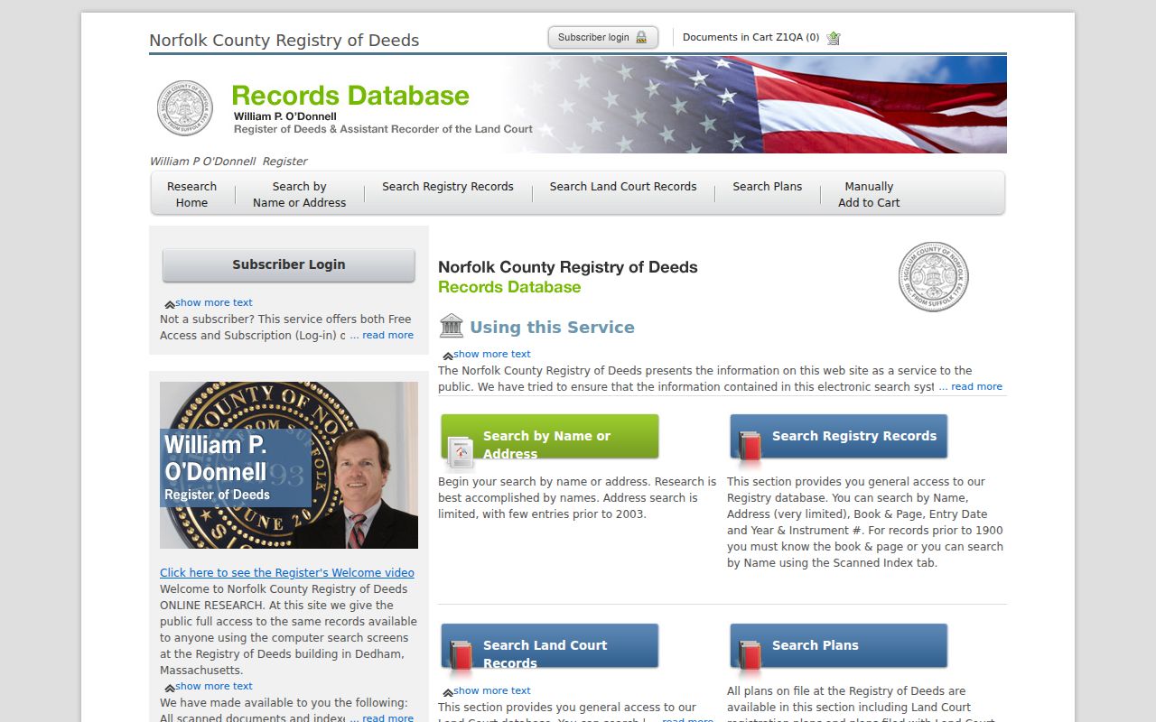
The index entry is the beginning of a Dedham ownership trail, not the final conclusion. Match its party names and references to the deed image, plan and parcel identifiers before adding a past owner to a house history.
Dedham Previous Residents in Directories
Deeds name parties to a transaction, while directories can capture the people who used an address. The 1889 History and Directory of Dedham, Mass. for 1889 included resident, street and business material, and the 1899 Dedham and Westwood directory included a map. State Library holdings list Dedham directory years from 1874, 1876-1877, 1893, 1896, 1899 and many selected years through 1949. A house guide is arranged by address, making it the key route from a street number to an occupant name.
The Museum's directories, telephone books, newspapers from 1796 and building files are an in-person reference route. The Dedham Public Library provides Ancestry Library Edition for in-library use, and the State Library and other repositories can supply the broader directory and voting-list shelf. The collections themselves remain the focus of the Dedham city directory; here, use one or two close years to place a household between deed transfers.
Directory evidence has limits. An address listing may name a head of household, a business, or an occupant, and a blank year may mean no volume was published or held. Preserve the spelling used in the volume and check the alphabetical section for an occupation or business clue when two people have the same surname.
Pair Dedham Past Residents with Census
Use a directory year as a bridge, not a substitute for a census. Federal census schedules through 1950 are public under the 72-year rule. They add ages, relationships, occupations and birthplaces, but the enumeration geography can differ from a modern Dedham street description. A census household should be matched with the address and time period, not assumed from a matching name alone.
- Copy the address, surname, spelling and directory year from the house guide or street section.
- Choose the closest public census year and compare age, relationship, occupation and birthplace with the directory entry.
- Check another directory year before and after the census. A move, business address or changed street number can explain a difference.
- Use the assessor parcel and Norfolk deed references to separate owner from occupant, then use obituary, probate, cemetery, church or newspaper material only as corroboration.
Probate can identify an executor, heir or mailing address at the end of a trail, but it is a court record and portions can be confidential. Start docket work through Massachusetts Trial Court Case Access, then request an official file or copy from the Norfolk Probate and Family Court clerk or archives route when the public docket points to a relevant case.
Dedham Past Residents and House Files
A building's history can explain a house number that does not line up with a deed or directory. The Dedham Museum & Archive keeps building-history files, maps and photographs, while the Massachusetts Archives digital Dedham folder contains building/index cards with fields such as street, use, owner, architect, inspector and date. Those materials connect a property to a dated use or owner record, but they do not prove continuous residence.
The Library of Congress 1892 Sanborn collection has six Dedham sheets that can establish a mapped footprint or use at that date. Pair a Sanborn observation with a directory, deed or archive card. For later changes, Dedham Building, Plumbing/Gas, Electrical/Wiring, Planning/Zoning, Conservation and Stormwater use OpenGov applications. Public historical filters were not confirmed, so request releasable records by exact address, date range and permit type from the responsible department or the Town's records-access officer.
Note: A permit can date work on a structure, but its applicant or owner field does not by itself establish who lived in the building.
Dedham Previous Residents Need Old Names
Dedham's historic labels can rescue a stalled search. East Dedham, West Dedham, Dedham Village, Green Lodge or Greenlodge, Oakdale, Manor and Riverdale appear in planning material, old directories and local newspapers. The Registry's Book 1, Page 2 refers to Green Lodge Meadow in 1793, showing why a modern neighborhood name can be useful when a modern street search fails. Route 128 also severed or renamed road segments in the wider local history record.
Search old and new spellings, town sections, neighboring municipalities and the deed's legal description. A modern ZIP is a delivery label, not an historic address. When two descriptions appear to conflict, compare the parcel/map/plan reference, adjoining owners and historic maps before deciding they concern the same Dedham property.
Use Dedham Previous Residents Carefully
House-history and family-history research work best when each record is treated as a dated observation. A tax parcel can identify an owner of record, a directory can suggest an occupant, and a deed can show a transfer. None automatically identifies all household members or proves continuous presence. Dedham's address-confidentiality protections, confidential voter records, court impoundment and redactions may also create a lawful gap in the record.
Lawful use. Use Dedham previous-resident records for family history, estate questions, house history and civic research. Do not use a name, address or record trail to stalk, harass or harm any person.
If an official record needs correction, ask the custodian that maintains it. A public-record request to the Town may be submitted through Dedham's records-request route; the Massachusetts Public Records Law generally calls for a custodian response within 10 business days, subject to its exemptions and fee rules.